Thunderstorms and Humidity: A Volatile Monday for Canberra
Overview of the Day
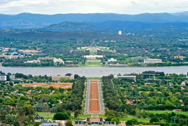
Canberra is bracing for a humid and potentially turbulent Monday, 9 February 2026. Residents can expect a mix of sunshine, high humidity, and a significant chance of rainfall throughout the day. Temperatures are forecast to range from a mild overnight low of 17°C to a warm daytime maximum of 29°C. While the heat is not record-breaking for February, the moisture in the air and the risk of atmospheric instability mean that the capital will likely see a return of the stormy conditions that impacted the region over the weekend.
Morning Forecast and UV Alerts
The morning will begin with partly cloudy skies and relatively calm conditions. However, the Bureau of Meteorology has noted a chance of early-morning thunderstorms, making the morning commute potentially damp for some suburbs. As the sun climbs, the UV Index is expected to reach the "Extreme" category. Health authorities recommend sun protection from as early as 9:00 AM, as the clear patches between clouds will offer little respite from the summer sun. Light winds are expected during the early hours, providing minimal cooling effect as the humidity remains high.
Afternoon Heat and Shower Activity
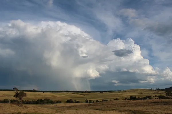
By midday, the temperature will climb toward the peak of 29°C. The atmosphere is expected to become increasingly unstable during the afternoon hours. There is a 70% medium chance of showers, with most of the precipitation likely to fall between the early afternoon and evening. Forecast models suggest a rainfall total of between 1mm and 5mm, though isolated areas under storm cells could see higher local totals. Specific predictions for the afternoon include:
- A continued risk of thunderstorms, potentially bringing heavy localized bursts of rain.
- Winds shifting to the East/Southeast at 15 to 20 km/h during the late afternoon.
- High humidity levels that may make the "feels-like" temperature higher than the actual 29°C reading.
Evening Outlook and Safety Notices
As the sun sets, the shower activity is expected to persist into the early evening before gradually clearing. The winds will eventually become light and variable overnight. This follows a period of significant activity for emergency services; the ACT State Emergency Service (SES) remains active in areas like Curtin and Yarralumla Creek following flash flooding and storm damage reported on Sunday. Residents are advised to monitor the latest weather updates, especially if planning outdoor activities or travel. While the Fire Danger Rating currently sits at "Moderate," the primary concern for today remains the potential for sudden downpours and lightning strikes during the predicted afternoon storms.

Shakespeare by the Lake and Lunar New Year Feasts Today in Canberra
Clear Skies and Cultural Spark: The Tuesday Morning Briefing

Major Delays Expected on Commonwealth Avenue and Arterial Roads